Cenomannica
Cenomannica | |
|---|---|
Territory of | |
 Picture of Cenomannica | |
| Nickname: Little Maine | |
| Motto: History Defines Us | |
 Map of Cenomannica | |
| Region | North America |
| Duchy | New Royton |
| Province | Greater Hoagland |
| Established | 11 August 2021 |
| Government | |
| • Emperor of Austenasia | Jonathan I |
| • Governor | Vacant |
| Area | |
| • Total | 0.00006 km2 (0 sq mi) |
| Time zone | UT-5:00 |
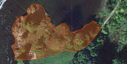
Cenomannica is a territory of the Empire of Austenasia located in the heart of historic Machias, Maine and is comprised of one plot of land overlooking the Machias River. The name of Cenomanncia is derived from the possible etymology of the State of Maine itself, that it being named in honor of the French province of Mayne, the name itself is in Latin. Cenomanncia was annexed on 11 August 2021 with the passing of the legislation for its annexation.
History and community
The English first became acquainted with the area in 1633, when Richard Vines established a trading post for the Plymouth Company at what is now Machiasport. The region has historical significance within the American Revolution including the Battles of Machias in 1775 and 1777. The region was briefly annexed by the United Kingdom during the War of 1812 and was named New Ireland.
Geography and climate
To the south and east is the Atlantic Ocean, and to the west is the state of Maine. With over 90% of its total land is forested or on the coast, Cenomannica is in the temperate broadleaf and mixed forests biome and is covered by the mixed oaks of the Northeastern coastal forests.
Climate
Cenomannica has a humid continental climate (Köppen climate classification Dfb), with warm and sometimes humid summers, and long, cold and very snowy winters. The region sees milder winters and cooler summers than inland regions as it mainly located on the coast. Daytime highs are generally in the 75–80 °F (24–27 °C) range throughout the state in July, with overnight lows in the high 50s °F (around 15 °C). January temperatures range from highs near 30 °F (−1 °C) on the coast. Precipitation in Cenomannica is evenly distributed year-round, and a slight late-fall or early-winter maximum along the coast due to "nor'easters" or intense cold-season rain and snowstorms. On the coast, the late spring and summer months are usually driest.
| Climate data for Maine Territory of Cenomannica | |||||||||||||
|---|---|---|---|---|---|---|---|---|---|---|---|---|---|
| Month | Jan | Feb | Mar | Apr | May | Jun | Jul | Aug | Sep | Oct | Nov | Dec | Year |
| Average high °F (°C) | 26 (-3.3) |
30 (-1.1) |
41 (5) |
50 (10) |
66 (18.9) |
69 (20.6) |
76 (24.4) |
76 (24.4) |
67 (19.4) |
57 (13.9) |
46 (7.8) |
33 (0.6) |
53 (11.7) |
| Average low °F (°C) | 4 (-15.6) |
11 (-11.7) |
22 (-5.6) |
32 (0) |
41 (5) |
48 (8.9) |
54 (12.2) |
53 (11.7) |
47 (8.3) |
39 (3.9) |
29 (-1.7) |
12 (-11.1) |
32 (0) |
| Source: Weatherbase | |||||||||||||

