File:1st Half of New Rome Map.jpg
Jump to navigation
Jump to search
Size of this preview: 773 × 600 pixels. Other resolutions: 2,560 × 1,986 pixels | 3,671 × 2,848 pixels.
Original file (3,671 × 2,848 pixels, file size: 2.07 MB, MIME type: image/jpeg)
Summary
| Description |
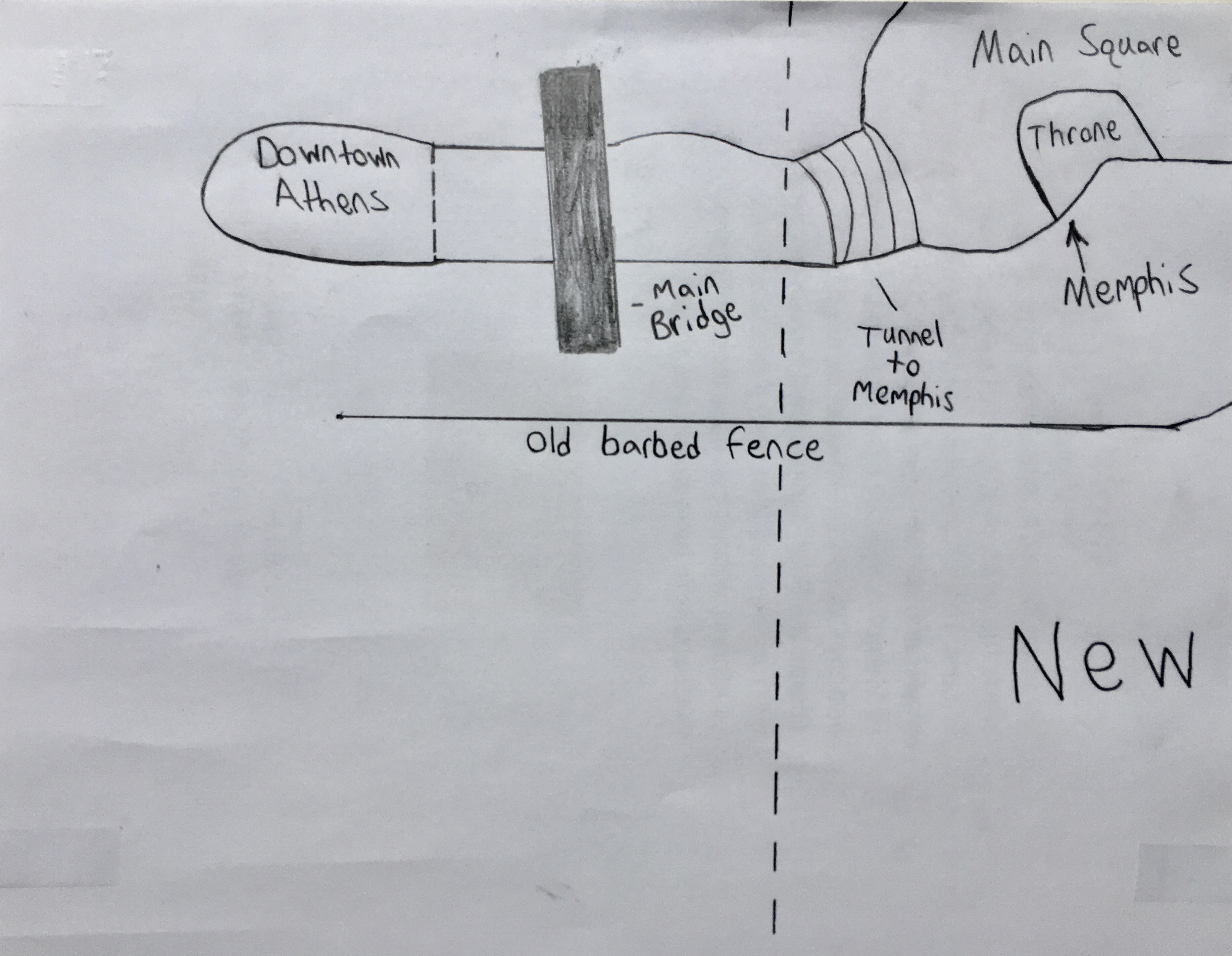
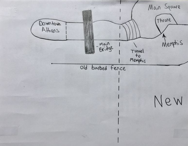
English: The first half of the map of the Empire of New Rome. |
|---|---|
| Source |
Own work |
| Date |
2020-07-15 17:44:55 |
| Author | |
| Permission (Reusing this file) |
See below.
|
43°48′28″N 91°12′13″W / 43.807708°N 91.203561°W There are spelling errors on the original map.
Licensing
I, the copyright holder of this work, hereby publish it under the following license:
|
File history
Click on a date/time to view the file as it appeared at that time.
| Date/Time | Thumbnail | Dimensions | User | Comment | |
|---|---|---|---|---|---|
| current | 23:03, 15 July 2020 | | 3,671 × 2,848 (2.07 MB) | Rtconqueror (talk | contribs) | User created page with UploadWizard |
You cannot overwrite this file.
File usage
The following page uses this file: