File:Adammia map.png
Jump to navigation
Jump to search

Size of this preview: 492 × 599 pixels. Other resolution: 1,250 × 1,523 pixels.
Original file (1,250 × 1,523 pixels, file size: 153 KB, MIME type: image/png)
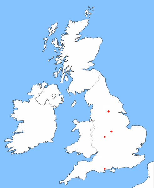
Map showing approximate locations of Adammic central region and colonies.
File history
Click on a date/time to view the file as it appeared at that time.
| Date/Time | Thumbnail | Dimensions | User | Comment | |
|---|---|---|---|---|---|
| current | 20:39, 13 July 2017 | | 1,250 × 1,523 (153 KB) | EmperorAdamI (talk | contribs) | Added Pererria |
| 02:13, 16 March 2017 |  | 1,250 × 1,523 (153 KB) | EmperorAdamI (talk | contribs) | Removed Burghlia | |
| 02:49, 14 November 2016 |  | 1,250 × 1,523 (153 KB) | EmperorAdamI (talk | contribs) | Added Midgard | |
| 19:49, 8 October 2016 |  | 1,250 × 1,523 (152 KB) | EmperorAdamI (talk | contribs) | Removed Borealia, added Burghlia and Alluria. | |
| 18:47, 8 August 2016 |  | 1,250 × 1,523 (151 KB) | Maintenance script (talk | contribs) | Importing file | |
| 16:15, 29 May 2015 | No thumbnail | 1,250 × 1,523 (151 KB) | EmperorAdamI (talk | contribs) | Removed Creatuxia | |
| 22:22, 27 November 2014 |  | 1,250 × 1,523 (58 KB) | EmperorAdamI (talk | contribs) | Map showing approximate locations of Adammic central region and colonies. Category:Empire of Adammia |
You cannot overwrite this file.
File usage
There are no pages that use this file.