File:CSR Map.jpg
Jump to navigation
Jump to search
No higher resolution available.
CSR_Map.jpg (504 × 520 pixels, file size: 88 KB, MIME type: image/jpeg)
Summary
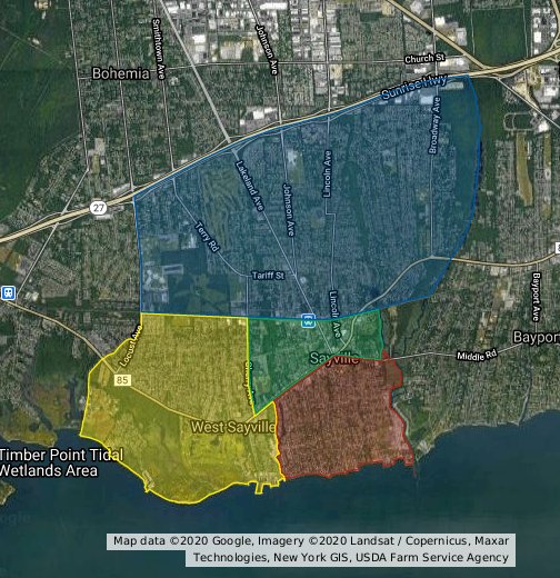
A map of land claims held by regions in the Commonwealth of Sayvillian Regions (CSR) and Sayville Sector.
File history
Click on a date/time to view the file as it appeared at that time.
| Date/Time | Thumbnail | Dimensions | User | Comment | |
|---|---|---|---|---|---|
| current | 01:52, 24 November 2020 | | 504 × 520 (88 KB) | Karlsbourg (talk | contribs) | A map of land claims held by regions in the Commonwealth of Sayvillian Regions (CSR) and Sayville Sector. |
You cannot overwrite this file.
File usage
The following 2 pages use this file: