File:Eintrachtian recognition of Antarctic micronations map.png
Jump to navigation
Jump to search

Size of this preview: 600 × 600 pixels. Other resolution: 640 × 640 pixels.
Original file (640 × 640 pixels, file size: 121 KB, MIME type: image/png)
Summary
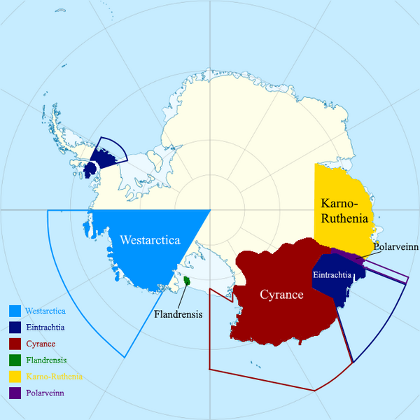
| Description |
English: The official map of the recognized Antarctic states by Eintrachtia. (updated 13th July 2022) |
|---|---|
| Source |
Own work |
| Date |
2022-07-13 |
| Author | |
| Permission (Reusing this file) |
See below.
|
Licensing
I, the copyright holder of this work, hereby publish it under the following license:
|
File history
Click on a date/time to view the file as it appeared at that time.
| Date/Time | Thumbnail | Dimensions | User | Comment | |
|---|---|---|---|---|---|
| current | 14:30, 13 July 2022 | | 640 × 640 (121 KB) | C.R.Eintrachtia (talk | contribs) | Uploaded own work with UploadWizard |
You cannot overwrite this file.
File usage
The following page uses this file: