File:Map-of-Julucan.png
Jump to navigation
Jump to search
Size of this preview: 800 × 471 pixels. Other resolution: 1,699 × 1,000 pixels.
Original file (1,699 × 1,000 pixels, file size: 1.14 MB, MIME type: image/png)
Summary
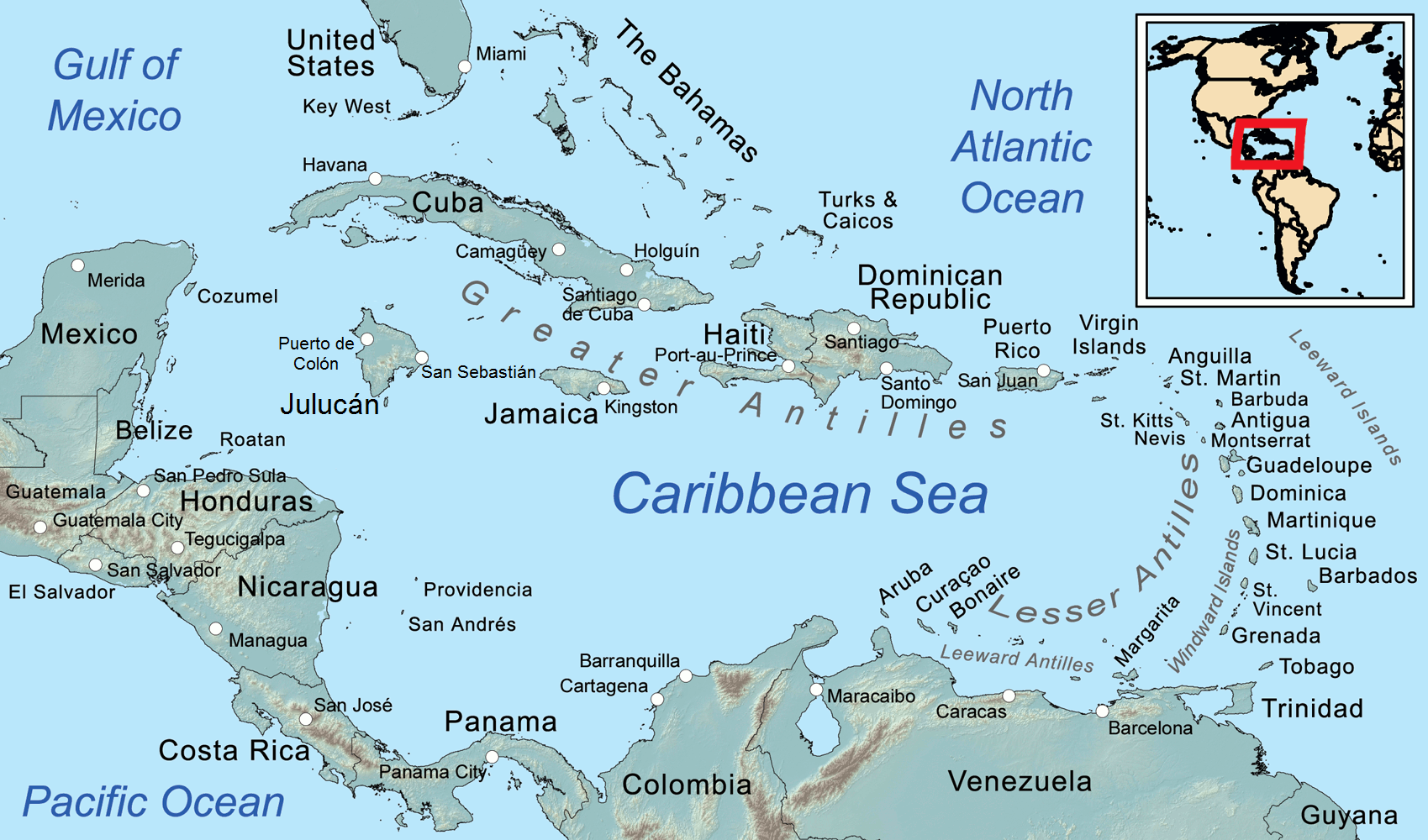
Map of Julucan and the location in the Caribbean ocean.
Licencing
I, the copyright holder of this work, hereby publish it under the following license:
{{{{{1}}}|dw=no|date=|migration= }}
|
File history
Click on a date/time to view the file as it appeared at that time.
| Date/Time | Thumbnail | Dimensions | User | Comment | |
|---|---|---|---|---|---|
| current | 18:51, 8 August 2016 | | 1,699 × 1,000 (1.14 MB) | Maintenance script (talk | contribs) | Importing file |
| 11:17, 23 June 2016 | No thumbnail | 1,699 × 1,000 (1.14 MB) | Gadrauhts (talk | contribs) | Map of Julucan and the location in the Caribbean ocean. |
You cannot overwrite this file.
File usage
The following page uses this file: