File:Map of Jusin.png
Jump to navigation
Jump to search

Size of this preview: 426 × 599 pixels. Other resolution: 2,000 × 2,813 pixels.
Original file (2,000 × 2,813 pixels, file size: 325 KB, MIME type: image/png)
Summary
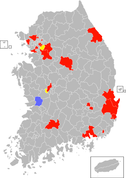
Map of Jusin in South Korea. Red colored parts include the actual territories. Yellow parts include autonomous territories. Blue parts include what used to be part of Jusin.
Licensing
| This work is used in accordance with the following copyright license: Proprietary, with usage permitted on MicroWiki. Author: Unknown. Origin: Unknown. |
File history
Click on a date/time to view the file as it appeared at that time.
| Date/Time | Thumbnail | Dimensions | User | Comment | |
|---|---|---|---|---|---|
| current | 17:35, 18 December 2018 |  | 2,000 × 2,813 (325 KB) | Misterms (talk | contribs) | Map of Jusin. |
You cannot overwrite this file.
File usage
The following file is a duplicate of this file (more details):
- File:Map of Jusin.png from Wikimedia Commons
The following page uses this file: