File:Map of Tytannia.png
Jump to navigation
Jump to search
Size of this preview: 347 × 599 pixels. Other resolution: 550 × 950 pixels.
Original file (550 × 950 pixels, file size: 77 KB, MIME type: image/png)
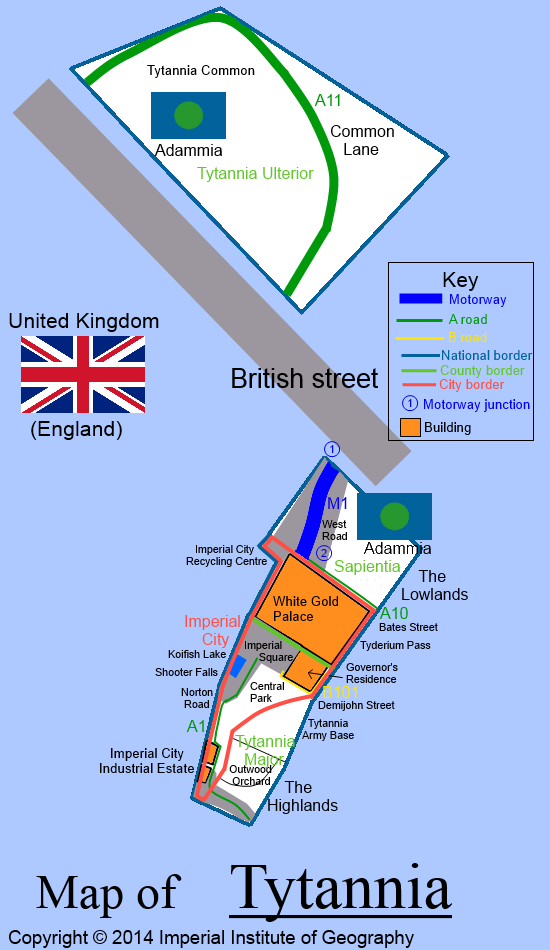
Map of Tytannia, Empire of Adammia produced by the Imperial Institute of Geography.
File history
Click on a date/time to view the file as it appeared at that time.
| Date/Time | Thumbnail | Dimensions | User | Comment | |
|---|---|---|---|---|---|
| current | 18:48, 8 August 2016 | | 550 × 950 (77 KB) | Maintenance script (talk | contribs) | Importing file |
| 20:27, 15 February 2014 | No thumbnail | 550 × 950 (77 KB) | EmperorAdamI (talk | contribs) | Map of Tytannia, Empire of Adammia produced by the Imperial Institute of Geography. |
You cannot overwrite this file.
File usage
The following 3 pages use this file: