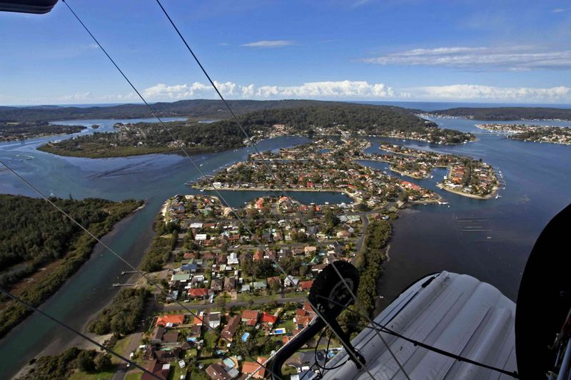
File:St Huberts Island aerial.jpg
Jump to navigation
Jump to search

Size of this preview: 800 × 533 pixels. Other resolutions: 2,560 × 1,707 pixels | 3,456 × 2,304 pixels.
Original file (3,456 × 2,304 pixels, file size: 268 KB, MIME type: image/jpeg)
Summary
{{Information |description=St Huberts Island from the air |date=2008-09-02 |source=https://www.panoramio.com/photo/13733745 |author=Ray Hayward |permission=CC-BY-SA 3.0
33°29′22″S 151°20′24″E / 33.489442°S 151.339931°E
Licensing
File history
Click on a date/time to view the file as it appeared at that time.
| Date/Time | Thumbnail | Dimensions | User | Comment | |
|---|---|---|---|---|---|
| current | 05:03, 6 December 2018 |  | 3,456 × 2,304 (268 KB) | Saripesia (talk | contribs) | {{Information |description=St Huberts Island from the air |date={{Original upload date|2008-09-02}} |source=https://www.panoramio.com/photo/13733745 |author=[https://www.panoramio.com/user/919085?with_photo_id=13733745 Ray Hayward] |permission={{cc-by-... |
You cannot overwrite this file.
File usage
The following file is a duplicate of this file (more details):
- File:St Huberts Island from the air - panoramio.jpg from Wikimedia Commons
The following page uses this file: