File:TME MAP.png
Jump to navigation
Jump to search
Size of this preview: 800 × 576 pixels. Other resolution: 927 × 667 pixels.
Original file (927 × 667 pixels, file size: 1.22 MB, MIME type: image/png)
Summary
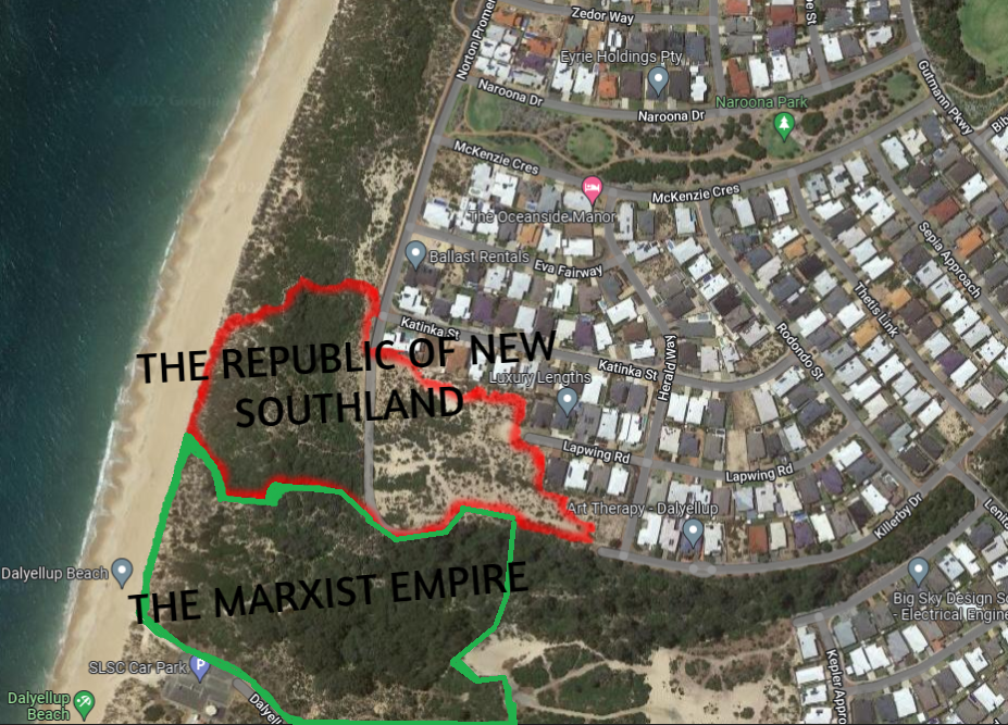
| Description |
English: A map of The Marxist Empire as well as New Southland, the country it borders |
|---|---|
| Source |
Own work |
| Date |
2022-09-25 |
| Author | |
| Permission (Reusing this file) |
See below.
|
Licensing
I, the copyright holder of this work, hereby publish it under the following license:
|
File history
Click on a date/time to view the file as it appeared at that time.
| Date/Time | Thumbnail | Dimensions | User | Comment | |
|---|---|---|---|---|---|
| current | 07:58, 25 September 2022 | | 927 × 667 (1.22 MB) | Frostbite (talk | contribs) | Uploaded own work with UploadWizard |
You cannot overwrite this file.
File usage
The following 4 pages use this file: