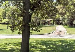
Fort Jerome
Fort Jerome | |
|---|---|
 Skyline of Fort Jerome | |
| Etymology: Named After the original traiding post, Fort Jerome | |
| Country | Kingdom of Wegmat |
| Province | Hilda |
| Government | |
| • Type | Council |
| • Body | City Council of Fort Jerome |
| • Mayor | Leven (Deer Party) |
| Area | |
| • City | 0.000029 km2 (0 sq mi) |
| • Land | 0.000029 km2 (0 sq mi) |
| • Water | 0.000013 km2 (0 sq mi) 0% |
| • Metro | 0.00 km2 (0.00 sq mi) |
| Elevation | 53 m (174 ft) |
| Population (2019) | |
| • City | 3 |
| • Density | 100,000/km2 (270,000/sq mi) |
| Wegmat Postal Service | 029 |
Fort Jerome is a city in Northern Hilda and is the northernmost point in the Inland woodlands. Fort Jerome has the largest school in Wegmat, the University of the Woods. Fort Jerome is the cultural center of the Inland Woodlands.
Geography
Fort Jerome is located just on the edge of Jerome Woods and Jerome Grassland. Western Fort Jerome is located on an island in the Des Plaines River. However most of the city is in the wooded area consisting of Fort Style buildings.
Transportation
Wegmat Route 4 comes into the city and terminates Just north of at the Wegmat-United States north border. Weg Ways terminates it's Des Plaines Line, Inland Woodlands line and Des Plaines Express. Fort Jerome Airport is the fifth busiest airport in Wegmat[citation needed] behind Prarik-Colorado Depot Intermicronational Airport and ahead of Two Pine Intermicronational Airport.