File:2017 map of Urabba Parks.jpg
Jump to navigation
Jump to search

Size of this preview: 800 × 600 pixels. Other resolution: 1,440 × 1,080 pixels.
Original file (1,440 × 1,080 pixels, file size: 1 MB, MIME type: image/jpeg)
Summary
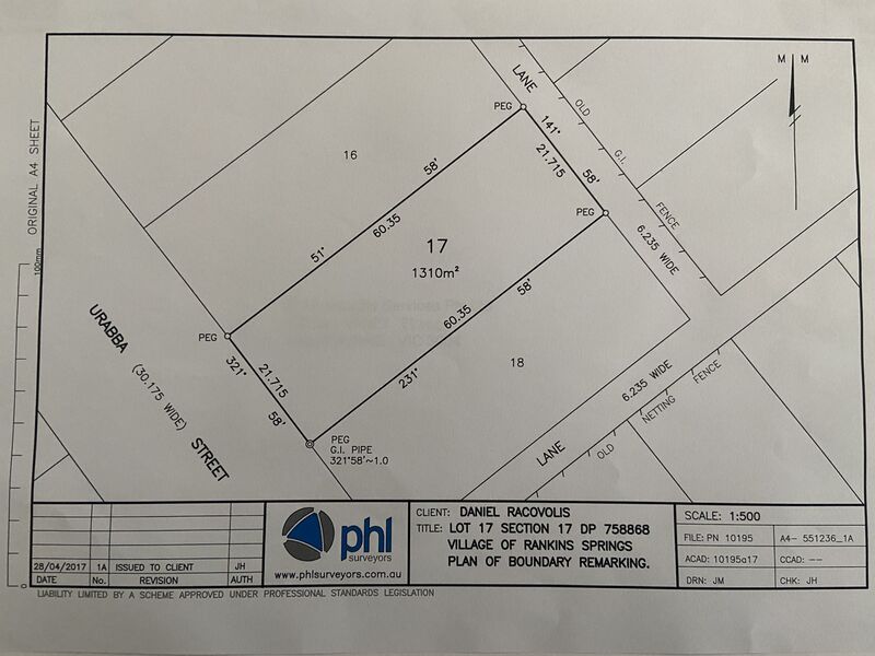
| Description |
English: Plan of boundary remarking of 4 Urabba Street Rankins Springs (Urabba Parks) by PHL Surveyors, Griffith |
|---|---|
| Source |
Own work |
| Date |
2017-04-28 |
| Author | |
| Permission (Reusing this file) |
See below.
|
Licensing
I, the copyright holder of this work, hereby publish it under the following license:
|
D.J. Racovolis Services Pty Ltd (the name faintly appearing in the middle of the document) is taken to be the creator of the work for this purpose as the client of PHL Surveryors, the actual creator of the work.
File history
Click on a date/time to view the file as it appeared at that time.
| Date/Time | Thumbnail | Dimensions | User | Comment | |
|---|---|---|---|---|---|
| current | 03:44, 30 July 2022 | | 1,440 × 1,080 (1 MB) | Racovolis (talk | contribs) | Uploaded own work with UploadWizard |
You cannot overwrite this file.
File usage
The following 2 pages use this file: