File:Easway on Biarmia and the Svalbard Isles official 2024 map.png
Jump to navigation
Jump to search
Size of this preview: 535 × 599 pixels. Other resolution: 850 × 952 pixels.
Original file (850 × 952 pixels, file size: 35 KB, MIME type: image/png)
Summary
| Description |
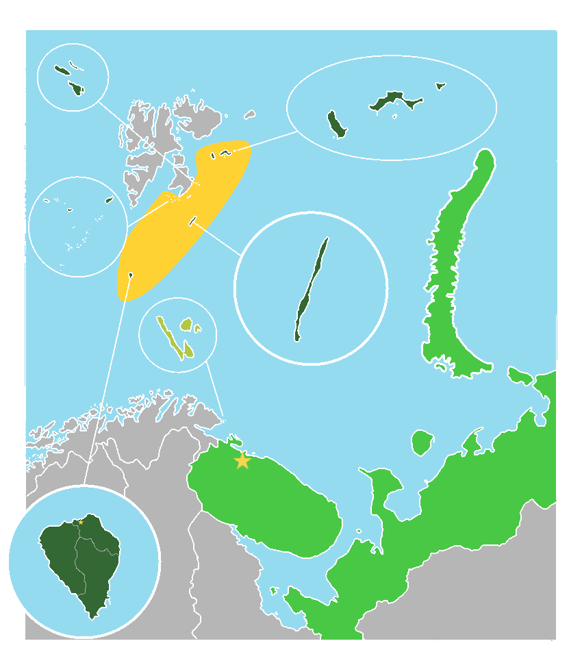
English: Official 2024 map of the Common Union of Easway on Biarmia and the Svalbard Isles, showing the full scope of claimed territory, with controlled territory in dark green and claimed, but not controlled territory, in light green. |
|---|---|
| Source |
Own work |
| Date |
2024-01-31 |
| Author | |
| Permission (Reusing this file) |
See below.
|
Licensing
I, the copyright holder of this work, hereby publish it under the following license:
|
File history
Click on a date/time to view the file as it appeared at that time.
| Date/Time | Thumbnail | Dimensions | User | Comment | |
|---|---|---|---|---|---|
| current | 00:38, 2 February 2024 | | 850 × 952 (35 KB) | Ezerryen (talk | contribs) | Uploaded own work with UploadWizard |
You cannot overwrite this file.