File:Iktmap.png
Jump to navigation
Jump to search
Size of this preview: 800 × 353 pixels. Other resolution: 1,102 × 486 pixels.
Original file (1,102 × 486 pixels, file size: 53 KB, MIME type: image/png)
Summary
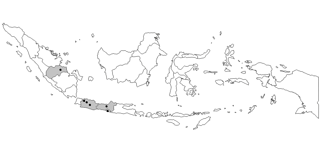
Map indicating locations of the Federal State of Indokistan (2013-2016)
File history
Click on a date/time to view the file as it appeared at that time.
| Date/Time | Thumbnail | Dimensions | User | Comment | |
|---|---|---|---|---|---|
| current | 06:07, 24 March 2020 | | 1,102 × 486 (53 KB) | Nabil nordamdie (talk | contribs) | Reverted to version as of 06:04, 24 March 2020 (UTC) |
| 06:07, 24 March 2020 |  | 1,104 × 496 (31 KB) | Nabil nordamdie (talk | contribs) | Reverted to version as of 05:17, 24 March 2020 (UTC) | |
| 06:04, 24 March 2020 |  | 1,102 × 486 (53 KB) | Nabil nordamdie (talk | contribs) | ||
| 05:17, 24 March 2020 |  | 1,104 × 496 (31 KB) | Nabil nordamdie (talk | contribs) | Map indicating locations of the Federal State of Indokistan (2013-2016) |
You cannot overwrite this file.
File usage
The following 2 pages use this file: