File:Map of Hugia.png
Jump to navigation
Jump to search

Size of this preview: 800 × 353 pixels. Other resolution: 1,279 × 565 pixels.
Original file (1,279 × 565 pixels, file size: 30 KB, MIME type: image/png)
Summary
| Description |
English: This image shows the counties of Hugia. |
|---|---|
| Source |
Own work |
| Date |
28 June 2023 |
| Author | |
| Permission (Reusing this file) |
See below.
|
Licensing
I, the copyright holder of this work, hereby publish it under the following license:
|
File history
Click on a date/time to view the file as it appeared at that time.
| Date/Time | Thumbnail | Dimensions | User | Comment | |
|---|---|---|---|---|---|
| current | 20:01, 4 May 2024 | | 1,279 × 565 (30 KB) | Henillion (talk | contribs) | Unorganized free territory ---> Norte (as of March 10, 2024) |
| 06:19, 1 March 2024 |  | 1,279 × 565 (30 KB) | Henillion (talk | contribs) | Easthro County loses its panhandle to a newly unorganized free territory and some land to Hugius County. Backystan also lost land to the new unorganized free territory. | |
| 03:23, 14 November 2023 | 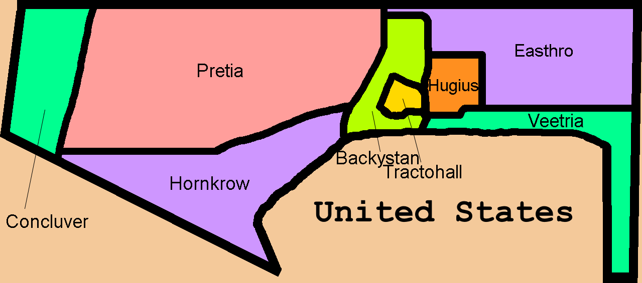 | 1,279 × 565 (29 KB) | Henillion (talk | contribs) | Bobila removed, county border changes | |
| 00:52, 7 November 2023 | 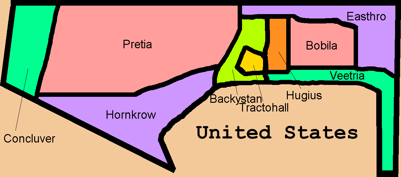 | 1,279 × 565 (32 KB) | Henillion (talk | contribs) | Reverted to version as of 00:43, 7 November 2023 (UTC) | |
| 00:52, 7 November 2023 | 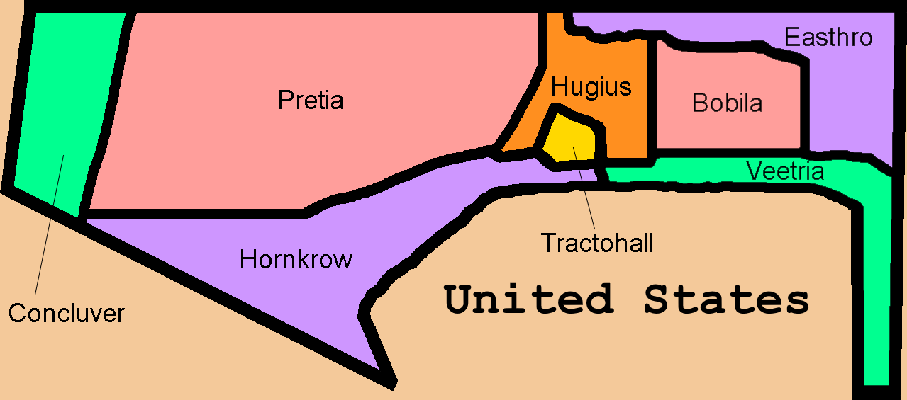 | 1,279 × 565 (32 KB) | Henillion (talk | contribs) | Reverted to version as of 23:22, 5 November 2023 (UTC) | |
| 00:43, 7 November 2023 |  | 1,279 × 565 (32 KB) | Henillion (talk | contribs) | New county added | |
| 23:22, 5 November 2023 |  | 1,279 × 565 (32 KB) | Henillion (talk | contribs) | Reverted to version as of 21:44, 5 November 2023 (UTC) | |
| 23:22, 5 November 2023 |  | 1,280 × 662 (21 KB) | Henillion (talk | contribs) | Reverted to version as of 06:30, 3 November 2023 (UTC) | |
| 21:44, 5 November 2023 |  | 1,279 × 565 (32 KB) | Henillion (talk | contribs) | More accurate map of Hugia | |
| 06:30, 3 November 2023 | 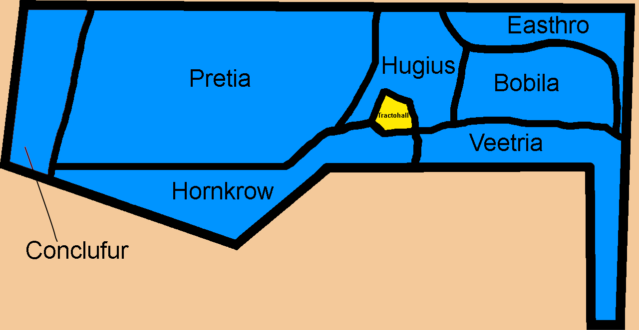 | 1,280 × 662 (21 KB) | Henillion (talk | contribs) | New map of Hugia and less administrative divisions |
You cannot overwrite this file.
File usage
The following 4 pages use this file: