File:Map of the Flandrensian Islands.jpg
Jump to navigation
Jump to search
No higher resolution available.
Map_of_the_Flandrensian_Islands.jpg (689 × 427 pixels, file size: 46 KB, MIME type: image/jpeg)
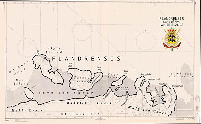
Summary
| Description |
English: Map of the Flandrensian Islands |
|---|---|
| Source |
Own work |
| Date |
2021-02-07 |
| Author | |
| Permission (Reusing this file) |
See below.
|
Licensing
I, the copyright holder of this work, hereby publish it under the following license:
|
File history
Click on a date/time to view the file as it appeared at that time.
| Date/Time | Thumbnail | Dimensions | User | Comment | |
|---|---|---|---|---|---|
| current | 10:49, 7 February 2021 | | 689 × 427 (46 KB) | Flandrensis (talk | contribs) | User created page with UploadWizard |
You cannot overwrite this file.
File usage
The following 5 pages use this file: