File:Map of the Grand Duchy of Naprzódsk, 2022.png
Jump to navigation
Jump to search

Size of this preview: 478 × 599 pixels. Other resolution: 1,034 × 1,296 pixels.
Original file (1,034 × 1,296 pixels, file size: 2.18 MB, MIME type: image/png)
Summary
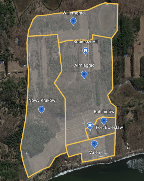
| Description |
English: Map of the Grand Duchy of Naprzódsk as of 21 September 2022, including Powiat Willemgrad, Powiat Nowy Kraków, Powiat Ałmiagrad, Powiat Bołchidów, Sobiesky Hill, Fort Bolesław, and Dzielnica Valen |
|---|---|
| Source |
Own work |
| Date |
2022-08-11 |
| Author | |
| Permission (Reusing this file) |
See below.
|
Licensing
I, the copyright holder of this work, hereby publish it under the following license:
|
File history
Click on a date/time to view the file as it appeared at that time.
| Date/Time | Thumbnail | Dimensions | User | Comment | |
|---|---|---|---|---|---|
| current | 17:43, 21 September 2022 | | 1,034 × 1,296 (2.18 MB) | A Polish Irishman (talk | contribs) | Uploaded own work with UploadWizard |
You cannot overwrite this file.
File usage
The following page uses this file: