File:Morgan Falls Islands Map.png
Jump to navigation
Jump to search

Size of this preview: 413 × 599 pixels. Other resolution: 678 × 984 pixels.
Original file (678 × 984 pixels, file size: 2.55 MB, MIME type: image/png)
Summary
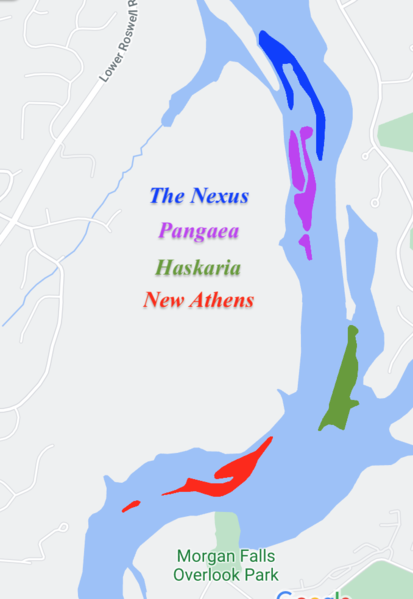
| Description |
English: A map of the territorial claims of the Morgan Falls Island Territories |
|---|---|
| Source |
Own work |
| Date |
2021-06-15 |
| Author | |
| Permission (Reusing this file) |
See below.
|
Licensing
I, the copyright holder of this work, hereby publish it under the following license:
|
File history
Click on a date/time to view the file as it appeared at that time.
| Date/Time | Thumbnail | Dimensions | User | Comment | |
|---|---|---|---|---|---|
| current | 13:44, 15 June 2021 | | 678 × 984 (2.55 MB) | NewAthens (talk | contribs) | Uploaded own work with UploadWizard |
You cannot overwrite this file.
File usage
There are no pages that use this file.