File:SaintMarcoufMap.png
Jump to navigation
Jump to search
Size of this preview: 678 × 599 pixels. Other resolution: 1,017 × 899 pixels.
Original file (1,017 × 899 pixels, file size: 1.96 MB, MIME type: image/png)
Summary
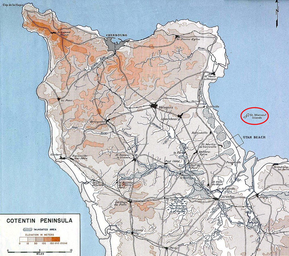
| Description |
English: Map of the Islands of Saint Marcouf |
|---|---|
| Source |
Utah Beach to Cherbourg (6 June-27 June 1944). Washington, Historical Division, Department of the Army, 1947. Map was one of a collection included with the book in a map envelope. Immediate source: www.history.army.mil, Map I |
| Date |
1947-01-02 |
| Author |
Historical Division, Department of the Army |
| Permission (Reusing this file) |
See below.
|
Licensing
| This work is in the public domain in the United States because it is a work of the United States Federal Government under the terms of Title 17, Chapter 1, Section 105 of the US Code. See Copyright. Note: This only applies to works of the Federal Government and not to the work of any individual U.S. state, territory, commonwealth, county, municipality, or any other subdivision. This template also does not apply to postage stamp designs published by the United States Postal Service since 1978. (See 206.02(b) of Compendium II: Copyright Office Practices). | .svg) |
File history
Click on a date/time to view the file as it appeared at that time.
| Date/Time | Thumbnail | Dimensions | User | Comment | |
|---|---|---|---|---|---|
| current | 12:04, 2 February 2024 | | 1,017 × 899 (1.96 MB) | ViscountMarcouf (talk | contribs) | Uploaded a work by Historical Division, Department of the Army from Utah Beach to Cherbourg (6 June-27 June 1944). Washington, Historical Division, Department of the Army, 1947. Map was one of a collection included with the book in a map envelope. Immediate source: www.history.army.mil, Map I with UploadWizard |
You cannot overwrite this file.
File usage
The following page uses this file: