File:Wood dale claims.png
Jump to navigation
Jump to search

Size of this preview: 800 × 556 pixels. Other resolution: 2,048 × 1,423 pixels.
Original file (2,048 × 1,423 pixels, file size: 3.24 MB, MIME type: image/png)
Summary
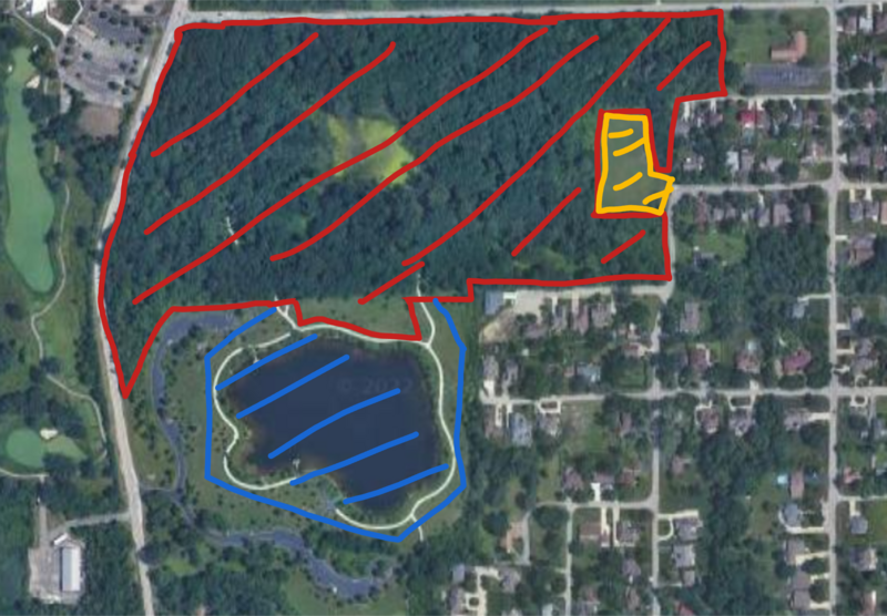
| Description |
English: A map of claims made on the Wood Dale Forest Preserve, with red being a direct annexation, yellow an unclaimed/occupied zone, and blue an exclusive fishing zone for citizens of the SCR |
|---|---|
| Source |
Own work |
| Date |
2022-11-09 |
| Author | |
| Permission (Reusing this file) |
See below.
|
Licensing
I, the copyright holder of this work, hereby publish it under the following license:
|
File history
Click on a date/time to view the file as it appeared at that time.
| Date/Time | Thumbnail | Dimensions | User | Comment | |
|---|---|---|---|---|---|
| current | 01:25, 10 November 2022 | | 2,048 × 1,423 (3.24 MB) | SCR Ian (talk | contribs) | Uploaded own work with UploadWizard |
You cannot overwrite this file.
File usage
The following page uses this file: