File:Ela'r'oech-Pontunia Map.png
Jump to navigation
Jump to search

Size of this preview: 690 × 599 pixels. Other resolution: 861 × 748 pixels.
Original file (861 × 748 pixels, file size: 83 KB, MIME type: image/png)
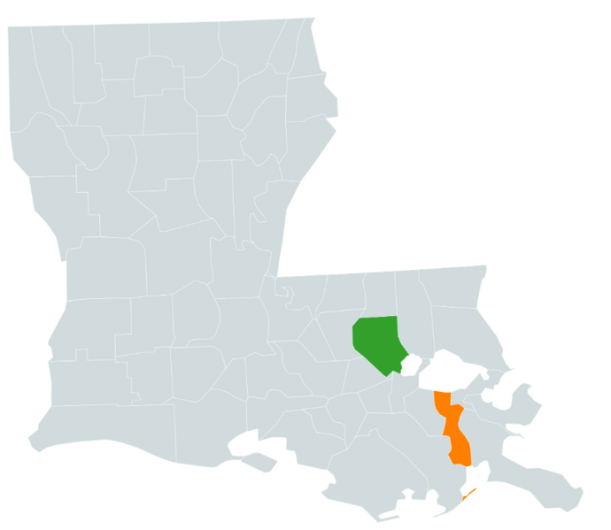
Map of Empire of Ela'r'oech and Pontunia's respective parishes in Louisiana.
File history
Click on a date/time to view the file as it appeared at that time.
| Date/Time | Thumbnail | Dimensions | User | Comment | |
|---|---|---|---|---|---|
| current | 13:13, 2 November 2023 | | 861 × 748 (83 KB) | Ela'r'oech Charles (talk | contribs) | |
| 13:08, 2 November 2023 |  | 6,900 × 4,326 (1.25 MB) | Ela'r'oech Charles (talk | contribs) |
You cannot overwrite this file.
File usage
The following 2 pages use this file: