File:Gerria map with cultural regions.png
Jump to navigation
Jump to search

Size of this preview: 683 × 599 pixels. Other resolution: 1,022 × 897 pixels.
Original file (1,022 × 897 pixels, file size: 1.53 MB, MIME type: image/png)
Summary
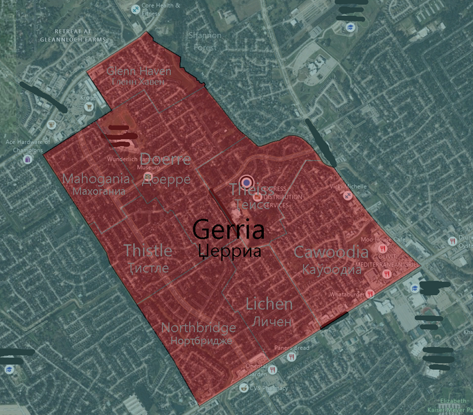
| Description |
English: A map of Gerria with its 7 cultural regions. |
|---|---|
| Source |
Own work |
| Date |
2023-11-23 |
| Author | |
| Permission (Reusing this file) |
See below.
|
Licensing
I, the copyright holder of this work, hereby publish it under the following license:
|
File history
Click on a date/time to view the file as it appeared at that time.
| Date/Time | Thumbnail | Dimensions | User | Comment | |
|---|---|---|---|---|---|
| current | 19:27, 6 May 2024 | | 1,022 × 897 (1.53 MB) | JunoTehPlanet (talk | contribs) | Gerria had already annexed the Glenn Haven Estates. |
| 23:52, 2 May 2024 |  | 1,022 × 897 (1.52 MB) | JunoTehPlanet (talk | contribs) | On 2 May, 2024, Gerria annexed a small portion of land to the west of the Theiss Gully, giving it to Doerre oblast. | |
| 17:44, 23 November 2023 |  | 1,022 × 897 (1.52 MB) | JunoTehPlanet (talk | contribs) | Uploaded own work with UploadWizard |
You cannot overwrite this file.
File usage
The following page uses this file: