File:Map of Gergenzed within Europe.png
Jump to navigation
Jump to search

Size of this preview: 719 × 600 pixels. Other resolutions: 2,455 × 2,048 pixels | 2,745 × 2,290 pixels.
Original file (2,745 × 2,290 pixels, file size: 2.31 MB, MIME type: image/png)
Summary
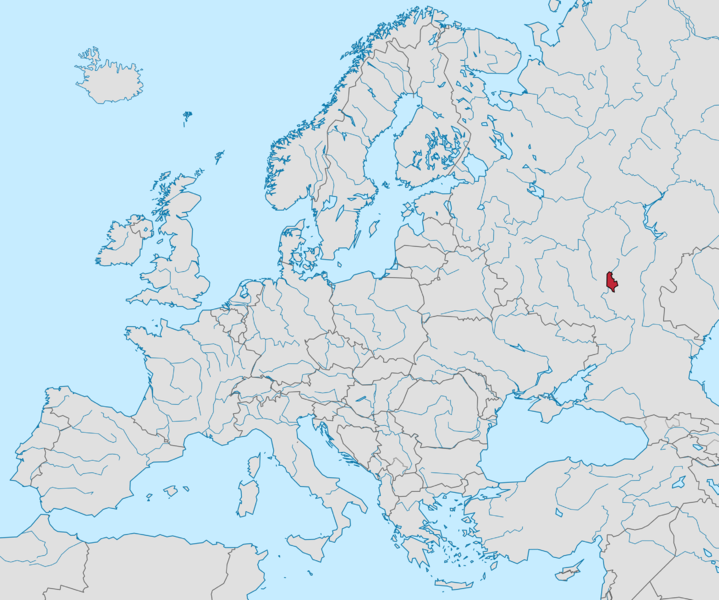
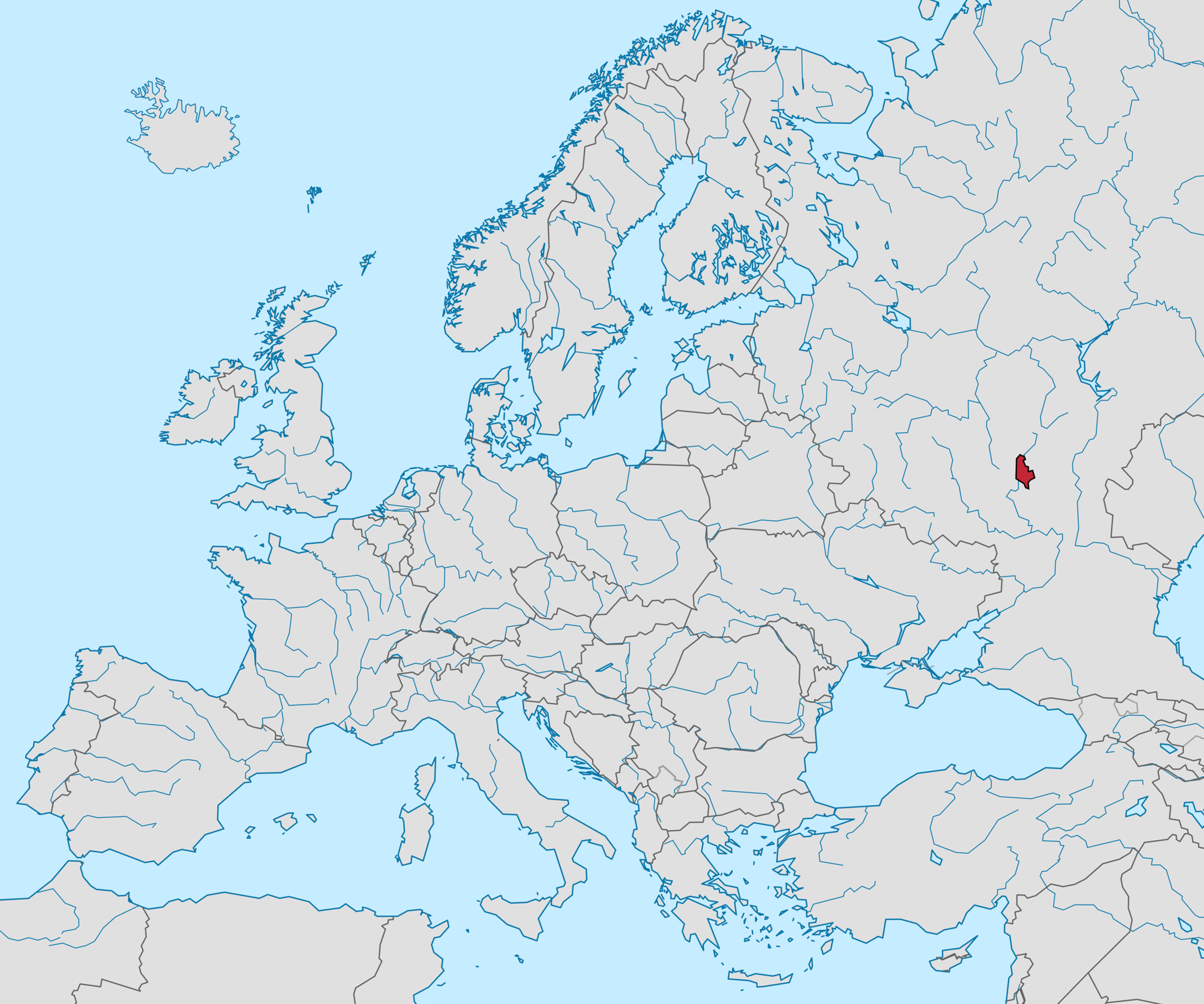
The map of the Gergenzedi Tsardom within Europe. The country's territory is shown in red
Licensing
| This work is used in accordance with the following copyright license: CC BY-SA 4.0. Author: Unknown. Origin: Unknown. |
File history
Click on a date/time to view the file as it appeared at that time.
| Date/Time | Thumbnail | Dimensions | User | Comment | |
|---|---|---|---|---|---|
| current | 21:32, 9 January 2022 | | 2,745 × 2,290 (2.31 MB) | Dchodz (talk | contribs) | The map of the Gergenzedi Tsardom within Europe. The country's territory is shown in red |
You cannot overwrite this file.
File usage
The following page uses this file: