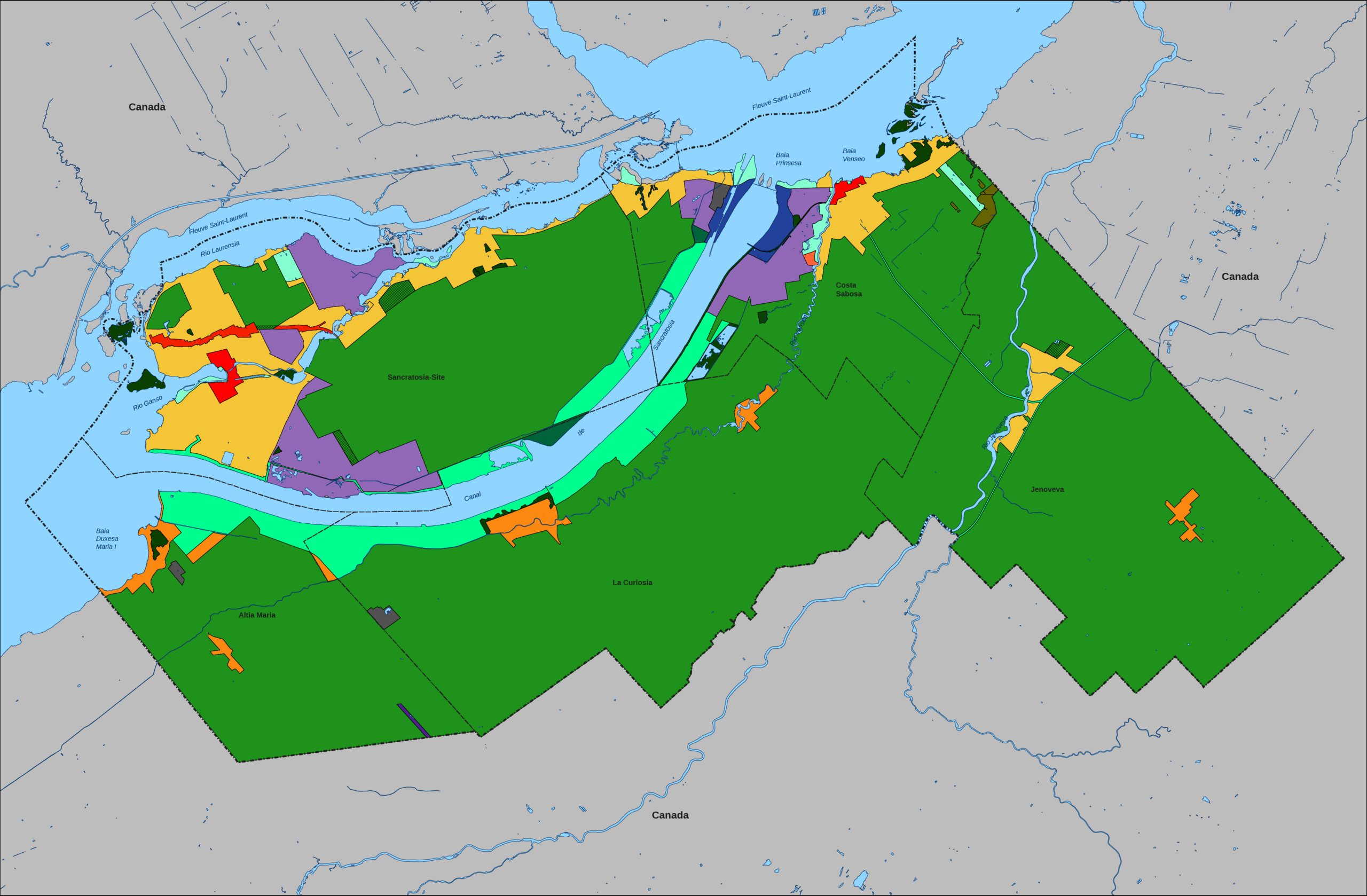
File:Sancratosian ceremonial territory map (Land use).png
Jump to navigation
Jump to search

Size of this preview: 800 × 524 pixels. Other resolutions: 2,560 × 1,678 pixels | 3,741 × 2,452 pixels.
Original file (3,741 × 2,452 pixels, file size: 1.23 MB, MIME type: image/png)
Summary
{{Information
|description=English: Land use map of the symbolic territory of Sancratosia.
Legend
Agricultural
Agroforestal
Commercial (Regional character)
Commercial (Transit character)
Conservation
Industrial (Regional character)
Industrial (Extraction nature)
Industrial (Environmenl nature)
Recreative
National Park
Touristic}
Urban
Urban (Downtown character
Urban (Rural character)
Public utilities
Licensing

.svg)
File history
Click on a date/time to view the file as it appeared at that time.
| Date/Time | Thumbnail | Dimensions | User | Comment | |
|---|---|---|---|---|---|
| current | 02:11, 7 February 2024 | | 3,741 × 2,452 (1.23 MB) | Cloe de Sancratosia (talk | contribs) | |
| 19:56, 30 November 2023 |  | 2,500 × 1,501 (474 KB) | Cloe de Sancratosia (talk | contribs) | ||
| 18:10, 30 November 2023 |  | 2,500 × 1,501 (473 KB) | Cloe de Sancratosia (talk | contribs) |
You cannot overwrite this file.
File usage
The following 2 pages use this file:
.png&redirect=no)
.png&oldid=1733344)