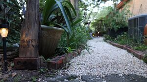
Roads in Northudankton


Roads in Northudankton play a significant role in connecting communities and facilitating transportation within the United Micro-Federation of Northudankton. The Community of Duikienin, serving as the capital community of Northudankton, features a network of roads that contribute to the accessibility and development of the area. These roads provide essential connections to various boroughs and landmarks within Duikienin.
Duisien District
St. Duisienbourgh Street serves as a central hub within Duikienin, running through the heart of Central Duikienin. This prominent road acts as a primary artery, connecting different parts of the community. It facilitates the movement of residents and visitors and serves as a focal point for various activities within the borough.
Old Avenue Street, previously known as Pineapple Avenue, and Pineapple Street, previously known as Parkway Lane, branch off from St. Duisienbourgh Street, further expanding the road network of Central Duikienin. These roads offer additional access to different areas of the community and contribute to its overall connectivity.
Among the notable intersections along Saint Duisienbourgh Street is the junction with Fort Jon Road, a significant roadway that intersects the thoroughfare, providing access to the historic Fort Jon in South Duikienin and its surrounding area. This intersection serves as a gateway to the historical attractions and landmarks associated with Fort Jon, enriching the cultural and historical fabric of Duikienin.
In addition, Saint Duisienbourgh Street intersects with South Duikienin Street, a road that extends throughout the southern reaches of the community. This road acts as a vital conduit, connecting the southern areas of Duikienin to the central district and beyond. South Duikienin Street facilitates smooth transportation flow, allowing residents and visitors to travel southbound from Saint Duisienbourgh Street, providing access to destinations outside the core of Duikienin.
Moreover, within the Saint Constance Court borough, Saint Constance Way intersects with Saint Duisienbourgh Street. Saint Constance Way serves as a local road within this borough, connecting residential areas, commercial establishments, or other points of interest in the vicinity. The intersection with Saint Duisienbourgh Street enhances accessibility and enables convenient travel to and from the Saint Constance Court borough, contributing to the overall connectivity of Duikienin.
| Name | Location (Borough) | Namesake |
|---|---|---|
| Saint Duisienbourgh Street (Main Street) | Central Duikienin, St. Constance Court, South Duikienin, East Duikienin Pass | Saint Duisienbourgh |
| Pineapple Street (previously Parkway Lane) | Central Duikienin | Pineapple Square |
| Old Avenue Street (previously Pineapple Avenue) | Central Duikienin | Previous name for the road, named after Pineapple Square |
| Blackberry Street | Central Duikienin | Populous fruit grown in Duikienin |
| Lottie Street | Saint Constance Court | Lottie Dah Freeman |
| Cookie Street | South Duikienin | Cookie Freeman |
| Fenceline Road | Central Duikienin, South Duikienin | Western fence of Duikienin city limits |
| Saint Constance Avenue | Saint Constance Court, South Duikienin | Regal Matron Saint Constance |
| Saint Constance Way | South Duikienin | Regal Matron Saint Constance |
| Fort Jon Road | South Duikienin | Ruins of Fort Jon of Duikienin |
| South Duikienin Street | South Duikienin | Borough of South Duikienin |