United Democratic Republic of Mackinac
This article needs more links to other articles to help integrate it into the encyclopedia. (April 2024) |
The Republic Of Lambert Hill is a micronation in North America. It is bordered by the United States,And Indiana.
History
Formation
In 2016, Governor Kaloz formed the United Democratic Republic of Mackinac as a peace seeking nation, and a country where the citizens can have all their rights, equality, and live what was supposed to be the American dream. He first declared independence on May 12, 2016, and wrote the declaration of independence. He then joined forces with Deputy Governor Mixter, and they signed the declaration, sealing the independence. They then proceeded to fly the first national flag on the date of full independence, July 16, 2016, and declared that date to be flag day, as Independence day was marked already as May 12. Kaloz declared himself as governor of the nation, and Mixter as the deputy governor.
Expansion
When the United Democratic Republic of Mackinac was originally formed, it only contained the Engadine Capital District, and went by the name of the Engadine Republic. Soon, President Kaloz decided to expand his territory, claiming the Townships of Garfield, Hudson, and Hendricks for the nation (merged as Garfield), on June 13, 2016. The current townships were referred to as districts of the nation, then.
He soon decided to claim the west half of Michigan's Mackinac County, and then declared the country's second name, the Republic of West Mackinac. This contained the districts of Garfield, Portage, and Newton. He then declared the nation to contain all of Mackinac County, and granted Vice President Mixter the eastern half of the country. They soon decided to merge the country as one and not have it split up between halves of the government.
When Vice President Mixter declared his previously dormant nation as active again, and he decided to expand his territory to take the northwestern part of Michigan's upper peninsula, but then decided to cede Houghton County back to the United States. They decided they wanted to border each other, and that Mackinac should border Canada, for help with refugees. Because of this decision, President Kaloz declared Luce and Chippewa counties as territories of Mackinac.
Population
- 56 259 (2013)
- 55 338 (2015)
- 56 264 (2017)
National Symbols
National Flower
- Iris
National Food
- Pasty
National Bird
- Golden Eagle
National Beverage
- Wine
National Condiment
- Maple Syrup
National Tree
- Sugar Maple
National Metal
- Copper
National Holidays
- Thanksgiving - March 20
- Independence Day - May 12
- Flag Day - July 16
- Negaunee Independence Day - July 17
- Negaunee Remembrance Day - September 17
- Governor's Day - July 28
Geography
The United Democratic Republic of Mackinac has 9 townships (acting the same as states do in the United States), 2 territories, and a capital district.
- Engadine Capital District
- Portage
- Newton
- Garfield
- Moran
- Brevort
- St. Ignace
- Marquette
- Clark
- Bois Blanc
- Luce Territory
- Chippewa Territory
Relations
- Formerly allied with the Negaunee Republic
Flags
-
The Flag of the United Democratic Republic of Mackinac
-
The Mackinac Naval Ensign
-
The Mackinac Air Force Ensign
-
The Mackinac Army Ensign
-
The Mackinac Coast Guard Ensign
-
The Mackinac Marine Corps Ensign
-
The Mackinac Space Corps Ensign
-
The Flag of the Liberty Party, also known as the MNSP (Mackinac Nationalist Socialist Party)
Flags Through Mackinac History
-
The first Mackinac Flag, with blue for the lakes and sky, with a green stripe in the middle for the Mackinac Bridge and the land. (December 2015-May 2016)
-
The second flag of the United Democratic Republic of Mackinac. (May–July 2016)
-
A previously suggested design for a Mackinac Flag, the 11 red and white stripes representing the 11 townships the country was formed from, the people, and their blood, with the canton resembling the second national flag. Now used as the Mackinac Ambassador's Ensign (June–July 2016)
-
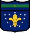
The third flag of the United Democratic Republic of Mackinac. The Fleur De Lis stands for the history of the nation, and the 11 stars for the 11 townships the country was formed from. (July 2016-September 2017)
-
An updated design for the Mackinac Ambassador's Ensign, with the canton resembling the third national flag. (June 2016-September 2017)
-
The Former Mackinac Naval Ensign
-
The Former Mackinac Air Force Ensign
-
The Former Mackinac Army Ensign
-
The Former Mackinac Coast Guard Ensign
-
The Former Mackinac Marine Corps Ensign
-
The Former Mackinac Space Corps Ensign
-
Obverse of the current flag of the United Democrcatic Republic of Mackinac, a slightly different version of the first flag, with darker colors, and a longer, 1x2 ratio, rather than a 3x5 ratio. Chosen for its simplicity, proving it a much better flag by the codes of the FIAV, ICV, and the NAVA. (September 2017 – Present)
-
Reverse of the current flag of the United Democrcatic Republic of Mackinac, with a gold star in the canton, to represent the 5 supports of the country; the people, the nature, the past, the present, and the future. (September 2017 – Present)


